Simply, Boulder is wrecked.
Dave got out of the neighborhood on his bike a few days after the worst of the rain and captured some photos of the area near our home.
We live in south Boulder near Table Mesa and Broadway. Although MANY people here are flooded with water and sewage, south Boulder was not as hard hit and the northern part (keeping in mind it's hardly a big city). Still, the devastation around us is awful. I don't want to minimize what people are going through at all by noting the south wasn't a bad. It's bad here too.
This first photo is taken on Broadway just south of Table Mesa. Locals will recognize what we know as the Shanahan Ranch. Or lake now.
This photo is taken right at our home. The flow had been far worse just 20 minutes before (Dave ran home and grabbed his camera). Still, I had never seen water here before. Who would have known it'd turn into white-water! From our front porch, we could hear the roar of the water. Pretty surprising sound from the house.
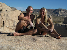
This is the Viele ditch. At least we all knew this had the purpose of carrying water. Not sure I'd ever seen water in it before. Dave is pointing to a death hole (eddy?) in the water to his left. The speed of the water was scary.
Someone with a sense of humor. I can't even recognize this place. Maybe Dave can provide some context to this photo later.

The day after 36 (Dave is standing on the Table Mesa overpass) reopened (at least into town- it was still closed out of town). The night before, this spot has 6-8' of water on it. If we had wanted to leave Boulder, we couldn't have. Trucks had cleaned all the junk off the road by the time this was taken. 

I've taken many visitors to the duck pond across the street. This is that tiny feeder of water to the pond. As the water receded, we learned that it is now covered in lovely potato sized rocks that came from somewhere. 

This is Marshall Road after the waters went down and it was passable. This is where Dave later found the 12" trout on the centerline gasping for life. :(
This is also Marshall Road. For those who have visited. This is where the Prairie Dog colony was (is?). We'd park here and walk to the left to visit them. I fear they all may have perished as there was no high ground for them.

Marshall Road. Though it seems intact, lots of work will be needed.
This is Table Mesa near King Soopers after the clean up. It was not passable before the big yellow machine with a blade cleared all the rocks and debris.
This is that little ditch on Table Mesa way after the water receded.
Table Mesa at the end of the road clearing.
Boulder Creek after it'd receded.
Unlike floods in Houston I've experienced, these flash floods come with lots of mud (and trees and rocks and houses and cars). So, even after clean up, things are pretty messy.
Residents were scrambling to divert water away from their homes. There was just so much water...it helped, but it didn't stop the water.Still widespread flooding.
Table Mesa cleaning
New waterways showed up in unsuspecting places
It's the iconic perspective of Boulder, Colorado. The subject is not the usual happy tourist though.
Chatauqua. All public space is closed due to danger until further notice. That includes all open space, all trails, climbing, and even many of the bike/pedestrian paths.
Boulder aftermath. This is 7th and Pleasant.
Always for aesthetics...someone left a pretty cairn.
Boulder Creek
Boulder Creek continued to go where it wanted for days.
Heed the sign.
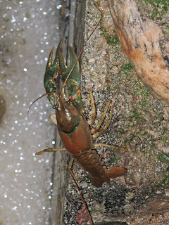
Who knew there were all these crayfish in Boulder? They were all desperately trying to find some dry ground.
Common sight.
Yeah, the over pass now hides the underpass.
Again
That's the bike path under this bridge.
Messy
The sign has a bit more meaning now.
A neighbor a few streets away. After the waters, homes started flooding with sewage given the sewage systems were overwhelmed.


