The third day in the Sierra was my 54th birthday and another fine granite adventure was on the docket; the northwest buttress of Tenaya Peak.
I had been camping in our top secret eastern Sierra bivy site, so after a
simple breakfast of tea, granola and chocolate donuts :), I was ready to
head to Tuolumne Meadows and Tenaya Peak.
The drive up Tioga Pass and into Tuolumne Meadows always gets me fired
up to climb on the fantastic stone of TM. I had never climbed Tenaya
Peak and it looked like a great line, so I was psyched to get on with
the birthday climb of choice:)
The approach is pretty straightforward and takes about 45 minutes from
the parking area near Tenaya Lake. As I would find out on the climb,
the views just keep getting better the higher you go!
The northwest buttress of Tenaya peak offers about 1500’ of quality
climbing up to about 5.5 in difficulty. You need to be attentive in a
few spots to stay on the line that offers the best quality climbing.
Time to change into rock climbing shoes!
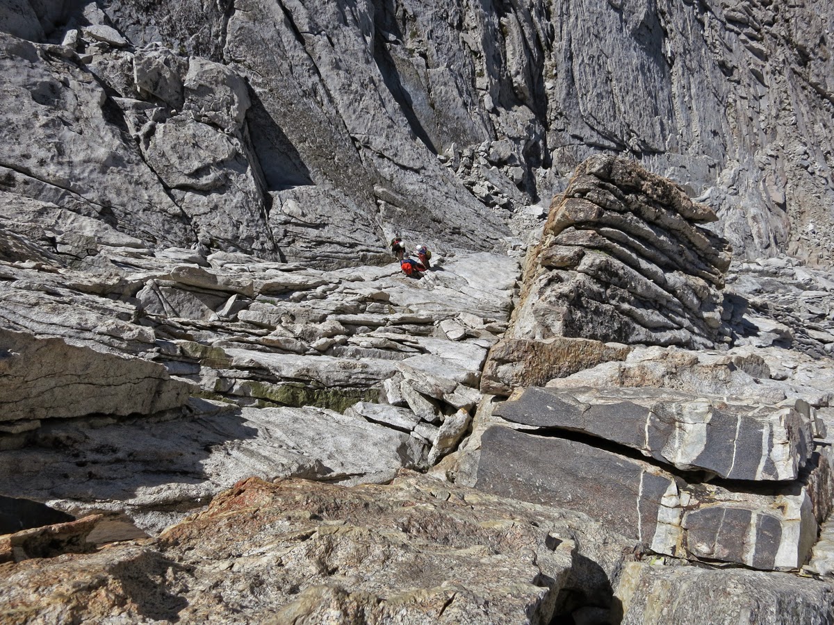
I
passed a couple of roped parties about 1000’ up the face where the
climbing gets a little steeper and the exposure gets a little bigger.
Right near the top, you can choose an easy exit left or finish up a cool
zigzag crack that goes right to the summit. I chose the latter for
more climbing fun and was soon on top admiring the views and perfect
Sierra weather! What a fun route!
Summit selfie at 54 years old!
After relaxing a while on the 10,311’ summit and sending out a summit
text via the DeLorme Explorer, I took a series of photos which I later
stitched into the panorama below – an amazing view in every direction!
You can see Half Dome and down into Yosemite Valley on the left (west)
portion of the picture.
The descent off Tenaya Peak takes a little while and is a little tricky
in spots, but soon enough I was back down at Tenaya Lake and enjoying a
refreshing dip in the lake for today’s dirtbag bath :). It was about
4.5 hours car to car.
I stopped at the Tuolumne store and got a cold beer to celebrate a fine
birthday adventure, then headed down the hill to my dirtbag bivy site
above Lee Vining. After a quick clean up using the solar shower, I went
down to the Mobil Station for their famous fish tacos – Eggzellent!!
A view of Tenaya Peak from the west. The route basically follows the skyline of the formation on the right side of the photo.
After a rest day, I spent two really fun days climbing high quality routes in Tuolumne Meadows. I climbed with a local named Bill who was nice enough to drive down from the Tahoe area for a couple of days of climbing.
We started off with Lucky Streaks, a fantastic 5.10d on Fairview Dome.
This is one of the best routes in Tuolumne in my opinion, offering up
about 750’ of super high quality climbing that requires an array of
skills.
Looking down the first two pitches of Lucky Streaks. You can see Bill - the little black dot.
The climbing stays pretty sustained for the entire route with everything from thin cracks to face climbing on knobs to hand cracks. Great stuff!
We had a quick rain and hail storm about half way up which forced us to take a breather and discuss philosophy.
Bill following the knob traverse on the fifth pitch.
Although the weather was unstable, windy and a bit cool, we had a fun time and were on the summit by early afternoon.
After eating some lunch at the base, we went over to Daff Dome and
climbed the uber classic Bombs over Tokyo, a great 5.10c thin crack
climb.
Here is Bill following the route.
At the base of the West Face of Daff Dome.
Another day in Tuolumne, Bill and I started out climbing the amazing
route OZ, a 5 pitch 5.10d on Drug Dome. I think this may just be the
best climb in Tuolumne, with steep and sustained climbing on beautiful
cracks and face for 500+ feet.
It doesn’t get much better than OZ, and the weather was great, so
another fine outing was in the bag!
After OZ, we drove over to Lembert
Dome and climbed the Direct NW Face, which is a really nice 3 pitch
5.10c. Again, really fun climbing, great weather – just another day in
Tuolumne!
Nice view of Lembert Dome. If you look closely in the very center of the photograph, you will see a Mountain Bluebird sitting on a branch.
A little bit wider view of Lembert Dome as a storm rolled through.
The super moon rising over the south shore of Mono Lake. Although a little hard to see, this is about a ten second time exposure and you can see the red blur of taillights from some cars on the highway in the lower portion of the photo.
Stay tuned for part 3 - Mt. Conness and Mt. Emerson.